Background
Bangkok has been notorious for its traffic congestion since the 1980s. I experienced that first hand as a child and teenager between 1994 and 2004. During those years the initial segments of the BTS SkyTrain and MRT subway were built and opened for service. It was an exciting time to be there for a Seattle kid who had only ridden buses.
Ron Morris’s 2Bangkok.com was the only English language source for news about Bangkok’s infrastructure development. He regularly featured translated updates, research, and commentary from Thai transport historian Wisarut Bholsithi. I checked the site daily and even made my own contributions.
With the BTS SkyTrain carrying passengers and the MRT subway well into construction, future plans seemed a bit more tangible and I was excited about was coming next. So I read through all the information that I could find about mass transit proposals and plans in 2Bangkok.com and drew maps to put it all together.
Notable in this map is the inclusion of Bangkok Governor Samak Sundaravej’s unrealized ring railway plan. You can see cancelled BTS extensions to Pin Klao (mostly replaced by the Orange Line), Sathorn (now the BRT), and Mahachai (duplicated SRT Red Line). I also included lines running under the expressways.
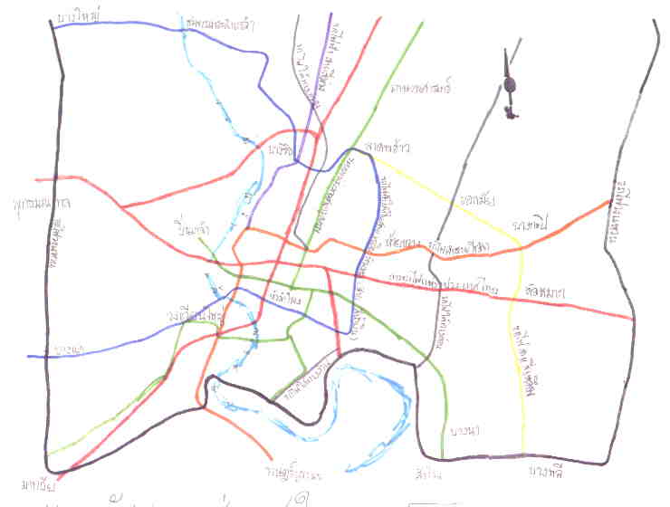
I don’t remember if this was the first one but it is one of the few surviving files on my computer. I probably printed out an official plan map, laid a fresh sheet of paper over it, and traced in the lines from the proposals I gathered with felt markers.
The 1995 map on 2Bangkok was comprehensive but hard to read so I drew a better version.
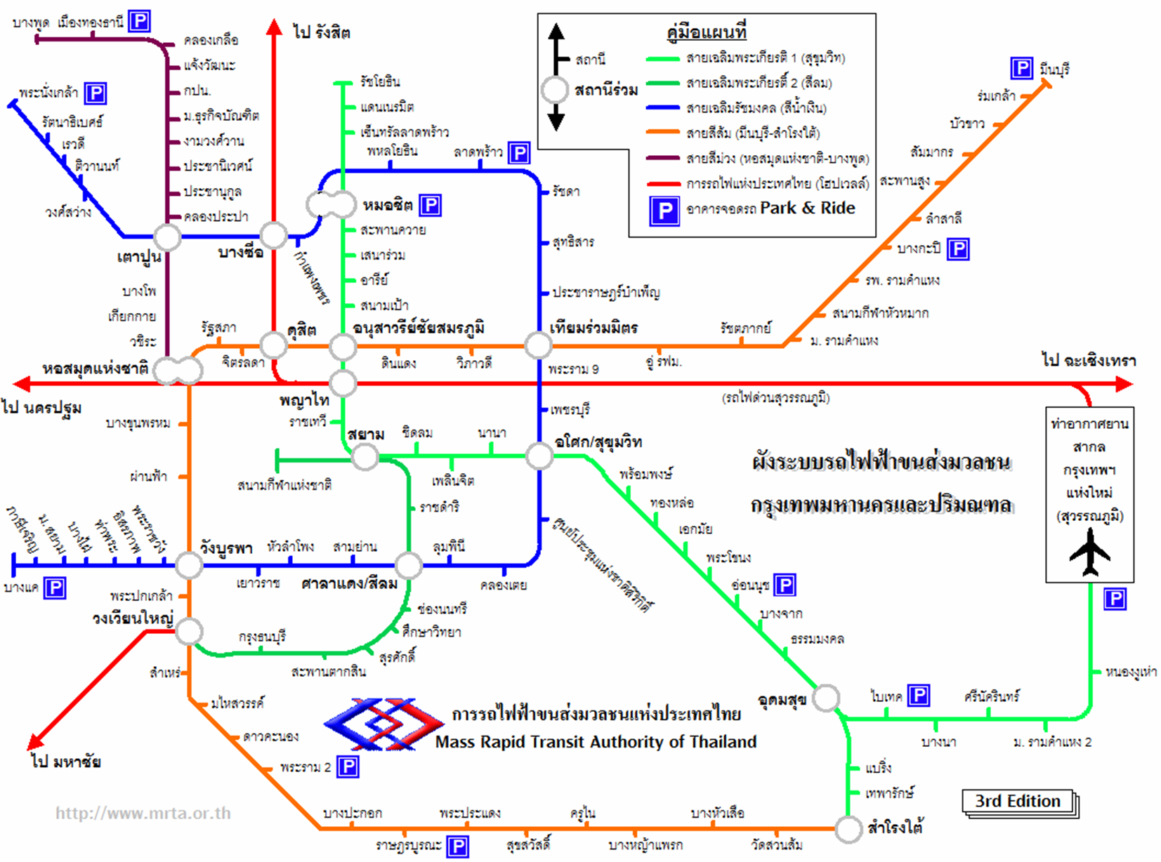
I don’t know where the 1st and 2nd editions of this map are. I only have the 3rd from 2002. I visited Singapore that year and was influenced by the MRT map, which in turn was influenced by the London tube map created by Harry Beck. I even tried to use their font at least for the bits of English on it. I had not picked up on their station codes. I did not learn Illustrator until a year later, so I drew it in Microsoft Powerpoint.
In 2004-2005, two maps by adults (remember, I was a teenager then) came out on 2Bangkok that I believe influenced the maps that followed due to how well drawn and professional looking they were.
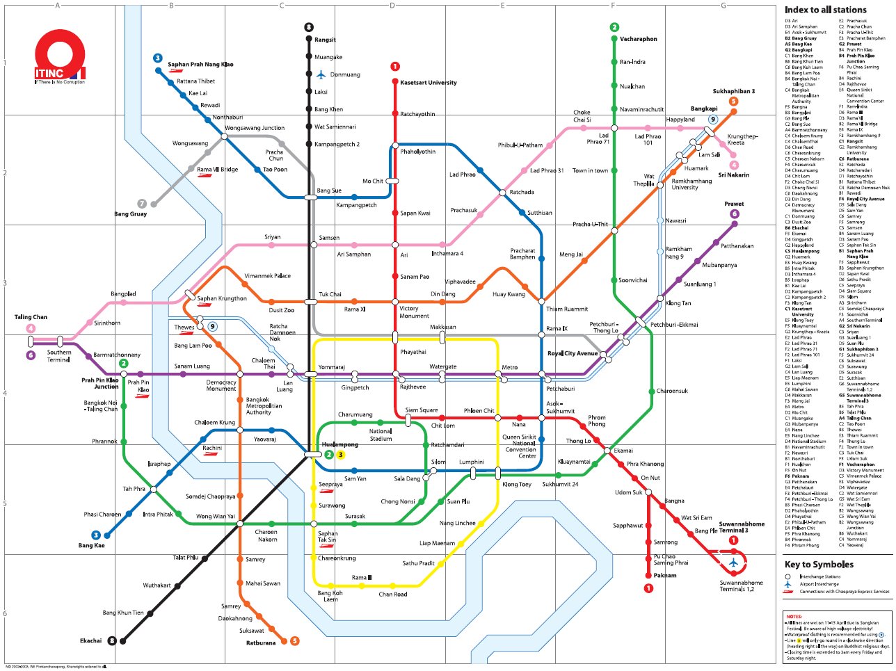
Wit Pimkanchanapong’s “If There is No Corruption” (ITINC) map is an art project that mixes existing and planned projects with those of the artist’s own ideas of Bangkok’s never completed mass transit system. 5,000 copies of the map were distributed in 2003. Stylistically, it is a mash up of the London tube map and the Paris Métro map.
A unique feature of the ITINC map is the depiction of the Saen Saeb canal and its boat service as “Line 9”. The canal itself flows into the Chao Phraya River using the same style. There are also humerous references to Thai culture in the map notes such as the Songkran Festival and the “Wien Tien” candlelight procession on Buddhist holidays.
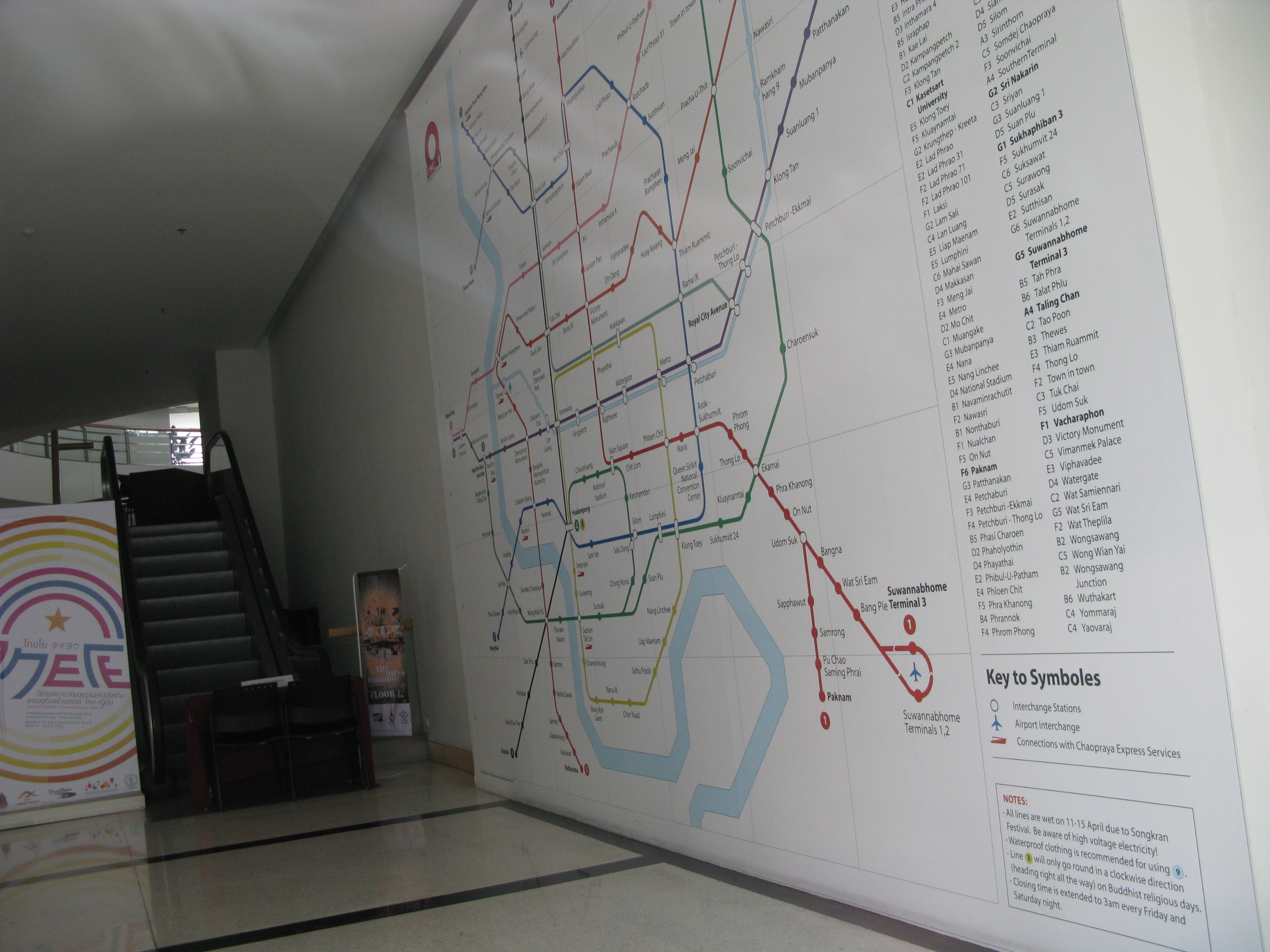
While the ITINC is a piece of art intended to be thought provoking, the next map by Chatchawal Phansopa is more an attempt to be an accurate representation of the future based on plans at the time.
Again, this map follows the Beck style of station ticks and interchange rings. The Saen Saep Canal was added in a later revision. Ko Kret, an island in the Chao Phraya River in Nonthaburi, was added. Notice how Bang Kachao, the bend in the Chao Phraya in the south of the map, as well as Ko Kret are drawn.
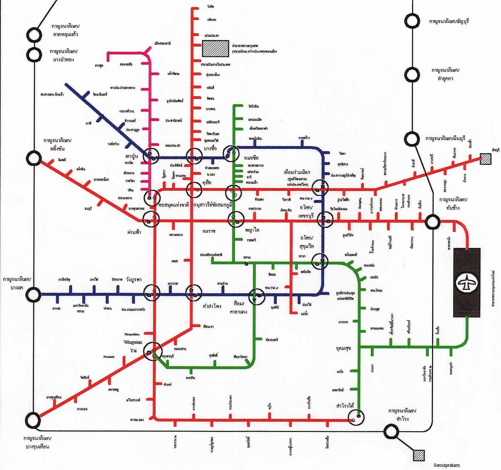
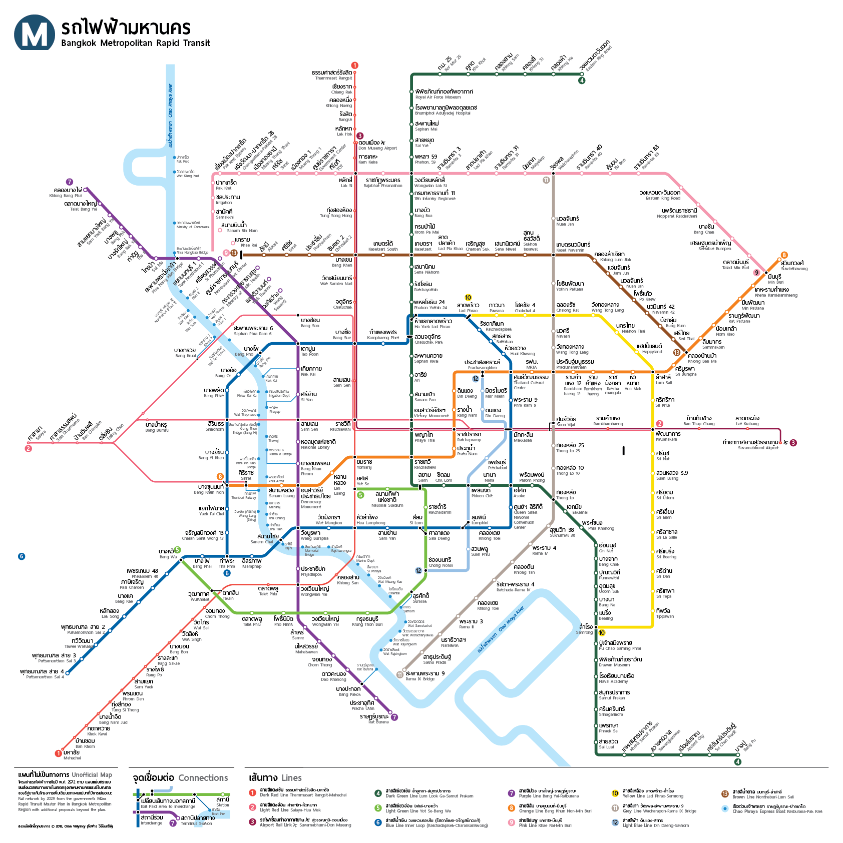
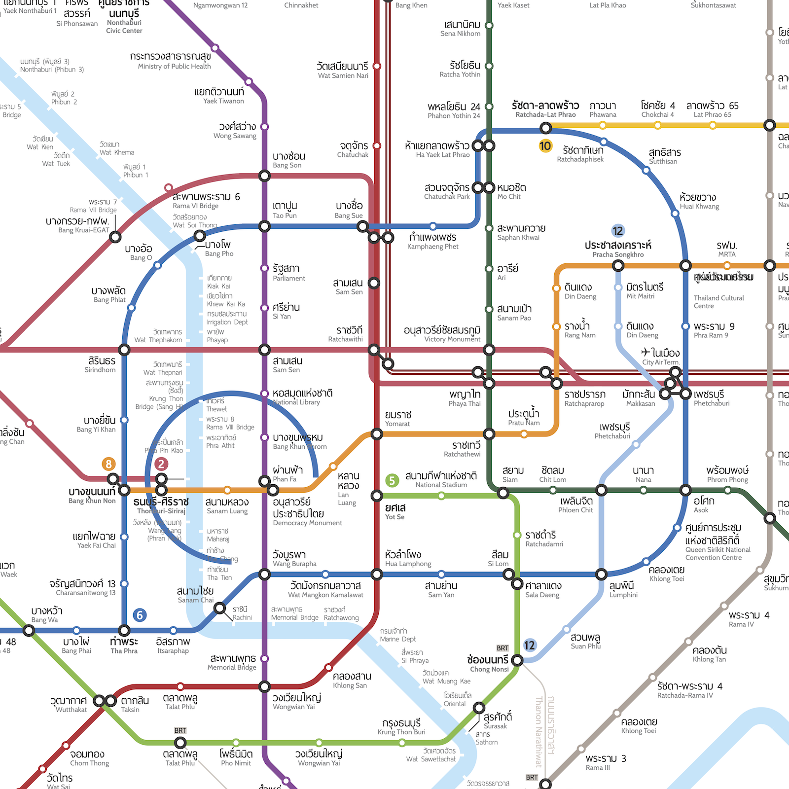
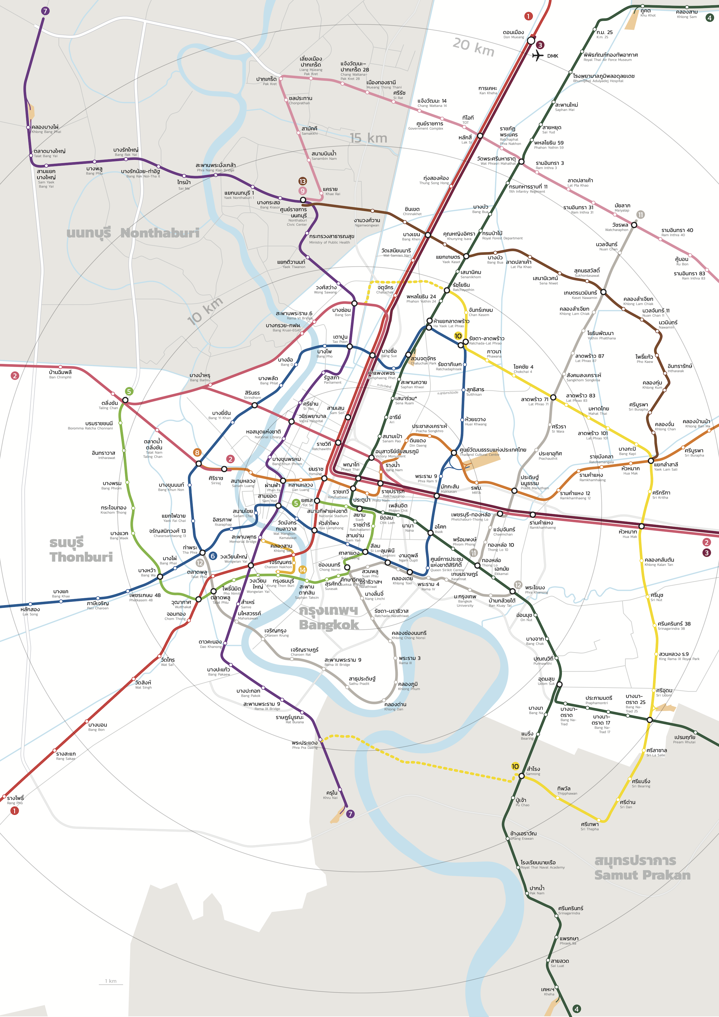
Up to now the maps I featured have been unofficial maps. This next map is important because it was published as part of the official Mass Rapid Transit Master Plan in Bangkok Metropolitan Region (M-MAP) in 2010.

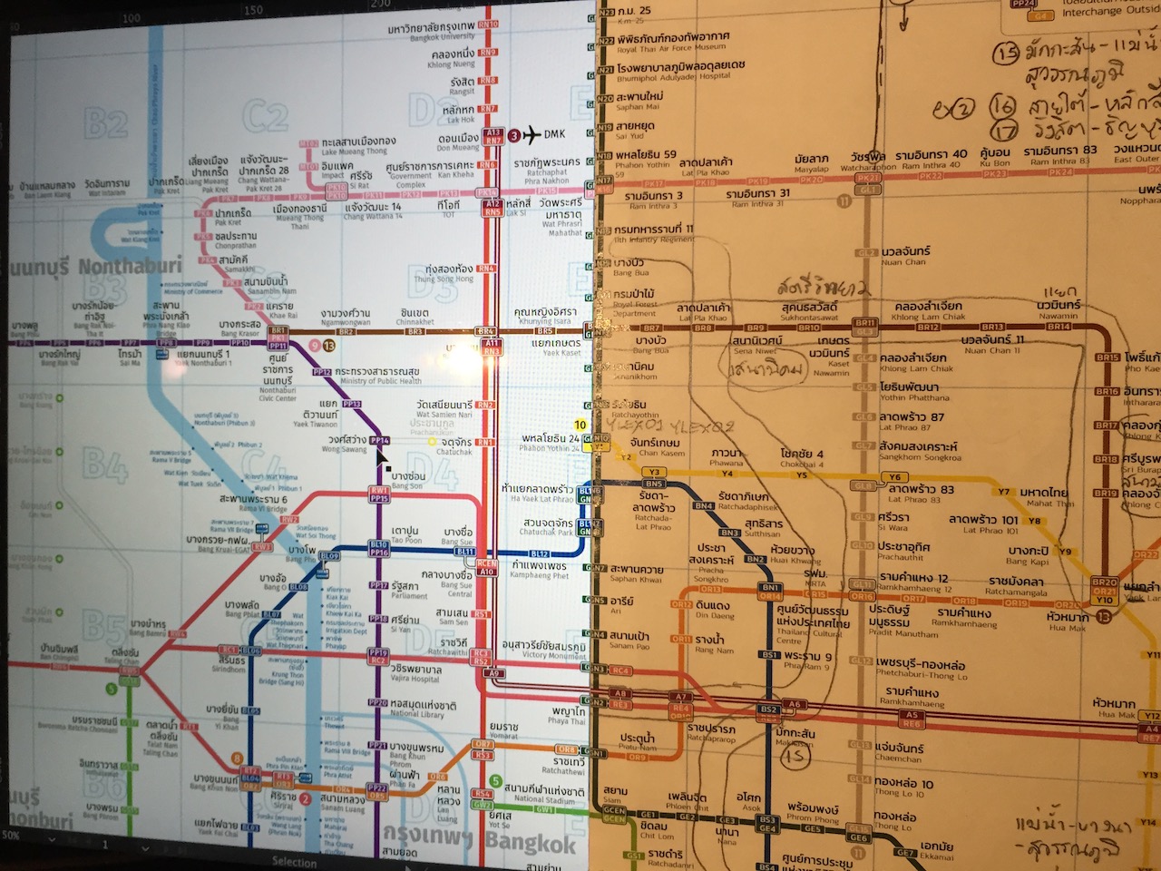
This diagram, though it clearly was influenced from Khun Chatchawal’s map, is not as elegantly drawn. They added two sharp bends in the Purple Line to match the actual shape of the route and crammed the Pink Line’s Tiwanon Road stations into a small space. The staggered labels on the Dark Green Line resulting from cramped station spacing are easily confused to be Red Line stations. Station labels are oriented horizontally, vertically, and diagonally. The needless inclusion of a very detailed plan for Suvaranbhumi Airport is bizarre.

I started honing my transit map making skills in college and was focused on reimplementing designs from world cities in a Seattle context. By 2012, I was finishing my masters degree in transportation engineering and used my transit map portfolio to get my current transit information designer job.
When I first saw the M-MAP I was excited about the plans but the schematic itself was disappointing. With all the experience and skills I developed over the years, I felt that I could take on draw my own map of a system of this scale.
version 1 (2013)
2013-03-24: Began work in Adobe Illustrator. “Bangkok Metro.ai” created.
2013-04-09: I posed a question on Twitter asking for “examples of well designed bilingual (non-Roman+Roman) transit maps/diagrams”. The recently released version 2.0 of Art Lebedev’s Moscow Metro map was cited.
2013-05-17: Work in progress map posted on Twitter.
2013-07-25: Tried angling the outer lines diagonally to make labels more readable. Experimenting with interchange symbology. A graphical in context legend.
I soon found out that I wasn’t the only person working on a Bangkok map. I first spotted this map on SkyscraperCity on August 19, 2013 while doing research on the latest plans.
Although I practically had a completed map, I kept tinkering with various aspects. Sorry that I did not keep many intermediate versions of the map to show its progress.
2014-02-11: Full map released on Flickr. Description from Flickr page:
A bilingual map of what rapid transit in Bangkok could look like if the current master plan is built. Proposed extensions not in the plan, like the BTS extensions along Bang Na-Trad Road, are also included. Line numbers and color designations are from the official Thai master plan map (old).
The Chao Phraya Express Boat has many different service patterns that cannot be shown here, so only piers are shown.
The current Bangkok BRT and proposed Pathum Thani rail feeder BRT lines are included. Short monorail projects like Chula-Siam are not included.
It is practically complete but I like to tinker with it occasionally so you will see minor edits here and there. I created this map because I wasn’t satisfied with the quality of maps out there and there was no single map that had both Thai and English information.
2014-02-12: Updated station names and corrected English names to conform to RTGS transcription, except certain proper names and commonly translated names. Added lines to line key.
2014-02-13: Corrected “Wat Sakul” to “Wat Salut” Station, “Bang Bumru” to “Bang Bamru”
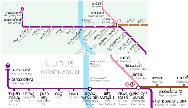
2014-02-15: Updated Yellow Line stations, Corrected Thai translation of BRT, Minor tweaks to romanized names. Removed express boat connection on southern Purple Line. Disambiguate the two Khae Rai stations by adding nearest sois. Added new Express Boat logo.
2014-02-16: Station label spacing tweaks, more English station name edits
2014-03-15: Variant of map released showing present day system.
2014-04-17: Tried out a more rounded Blue Line loop and even a circular Blue Line

2016-08-21: Created commemorative map for the inauguration of MRT Purple Line service
version 2 “station codes” (2017)
2017-01-16: Started work on 2nd version of map to include alphanumeric station codes
2017-04-30: Started work on station locator index
2017-08-27: Registered bangkoktransitmap.com domain name
2017-10-19: Created a geographic version of map from self-created GIS data
2018-10: Began updating map to include preliminary proposals from M-MAP2
2019-06-29: Added teaser to website
2019-10-06: Launched website
2019-12-05: Added special 1999 version of map to commemorate 20th anniversary of the BTS Skytrain
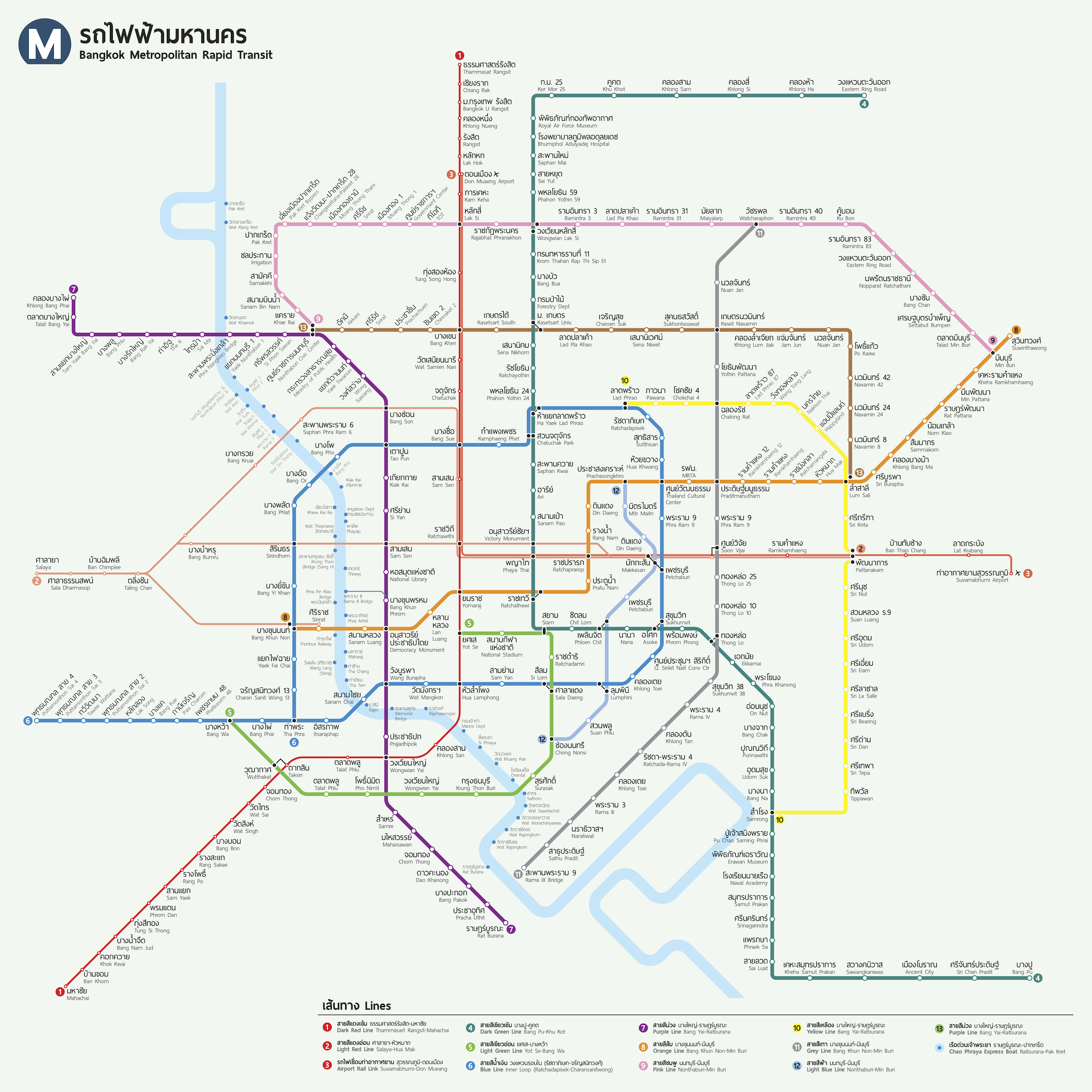
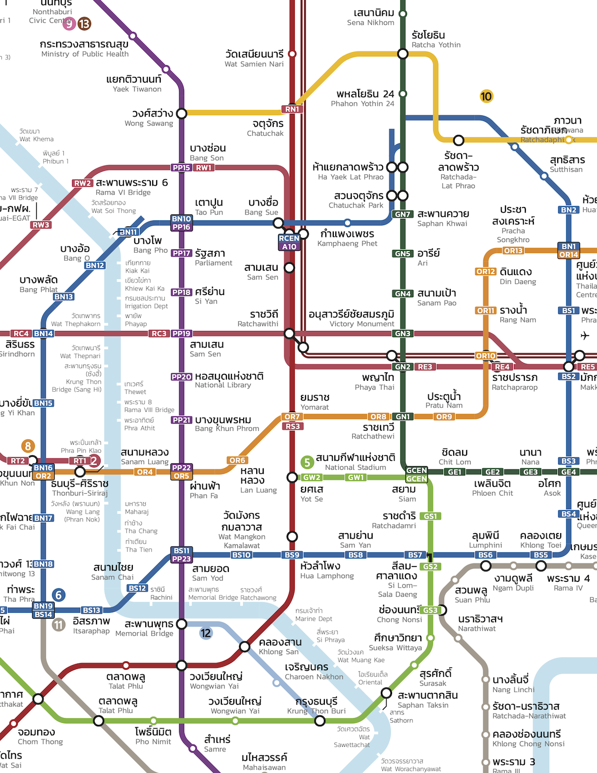
version 3 (2023)
Latest version online at bangkoktransitmap.com.
Initial changes (2023-02-05):
- Changed font from a Thai loopless sans-serif to a Thai looped sans-serif to improve legibility of Thai characters. Boon is a free and open source font.
- Revised station symbol design to be more like Version 1 map while retaining station codes.
- Regular station symbol has color border matching line color with white background and station code in black
- Interchange station symbol has black border with background in line’s color and station code in white
- BTS Skytrain stations have circular symbols, matching system’s style
- All other stations have rounded square symbols instead of long rectangles. These look better on horizontal line segments.
- The walking distance for out of station interchanges are distinguished by a solid black line for walks less than 200 meters and a dotted line for walks more than 200 meters but less than 400 meters.
- Introduced greater line curvature to the map’s framework for a rounder feel.
- Experimented with various curve radii for the MRT Blue Line circle and other lines.
- SRT long distance service changes
- Station symbols made consistent with other lines.
- Line style changed from line with bars to a striped line for a more streamlined look.
- Adopt SRT red color.
- Add continuation labels for the principal long distance lines.
- Joint stations with the SRT Red Line use a train symbol in place of the station code.
- Route reconfiguration for long distance service move to Krung Thep Aphiwat (Bang Sue Grand)
- River/canal boat line changes
- Added pier codes to most piers on Chao Phraya River and key piers on Khlong Saen Saeb.
- Pier symbology consistent with rail stations in showing interchanges.
- Linework on river streamlined to remove jogs between piers on opposite sides. Pier symbol positioning indicates side of river.
- Added service operators to list in legend
- Removed canals that did not have regular, all day passenger boat service.
- Added note for rush hour service to Pak Kret.
- Legend now groups lines by network (BTS, MRT, SRT) or mode (rail vs other)
- Station label placement prioritizes primary language (default: Thai). The primary label is always placed nearest its station symbol. The secondary language label (default: English) is placed outward below, above, or next to the primary label. This will facilitate translation of labels into other languages.
- Park & Rides at stations are now indicated.
- Planned line style revised to be less intrusive.
- Removed certain future lines/extension not yet officially confirmed in a plan or study.
- Airport express bus color toned down.
- Intercity bus terminal symbol background changed to match airport’s.
- Pink and Yellow Line station names revised to match operator’s map.
- Upgraded MRT Purple Line south section status to under construction
- Added optional layer showing travel times between stations and along key segments for lines in operation.
- Opened up station spacing on SRT Dark Red Line north of Lak Si.
- Changed color of BTS Silom Line and Gold Line to match operator’s official color.
- Reorganized menu UI.
2023-02-06 changes:
- Legend/Guide
- Changed order of sections to put Symbols before Lines
- Changed “Approved”/“Design” line status to “Tendering” to denote a project that has been approved by the Cabinet, passed environmental review and design, and is ready for construction.
- Added opening years for MRT Purple (south) and MRT Pink (MT spur).
- Revised “Airport Express Bus” to “Airport Expressway Bus”
- Revised Future Corridors section to include extensions of existing lines.
- Added credit and link to Sanjorn site (this page) in more prominent location
- Differentiate MRT Pink Line MT spur from mainline for legend purposes.
- Added future line emblems to more planned extensions.
- Added toggle for travel time layer.
2023-06-03 changes:
- MRT Yellow Line opened for public trial between YL11 and YL23. Station and line status changed.
- Added names of operating companies, including for MRT Yellow Line.
- Updated Leaflet to 1.9.4.
2023-06-10 changes:
- MRT Yellow Line stations open between YL02 and YL23 as of June 12. Added interstation travel times.
2023-06-19 changes:
- Full MRT Yellow Line opened
Goals:
- Structure map to add more interactivity
- Update lines and stations. Continue to accomodate future expansion plans.
- Add language pairs other than Thai and English.
- ‘Dark mode’ for map
- Update print and poster version
the Map in Use
Since its debut on Flickr, the map has found its way to places I never expected like appearing on TV or being adapted by transit agencies for their use. So far there have been over 60,000 views on Flickr alone plus countless others on its copies. I never really promoted the map much myself so I am surprised by the response. All I can hope for is that it inspires people to create something better and spread good design.
Press coverage
- Richard Barrow. Latest Progress Reports for Electric Trains in Bangkok, 2014-02-17
- MThai News. ผ่านบ้านใครบ้าง ? เปิดแผนที่ฉบับเต็ม รถไฟฟ้า-ใต้ดิน ถ้าเสร็จหมดทุกสาย, 2014-10-12
- Coconuts Bangkok. Happy HBDna: BTS Skytrain turns 20, see how much it’s grown (Map), 2019-12-06
Inspired
Render Thailand’s Bangkok and Vicinity Rail Transit Network Map
](https://sanjorn.com/studio/bangkok-transit-map/Screenshot_2020-07-18Facebook.png)
Bangkok Expressway and Metro PCL (BEM)
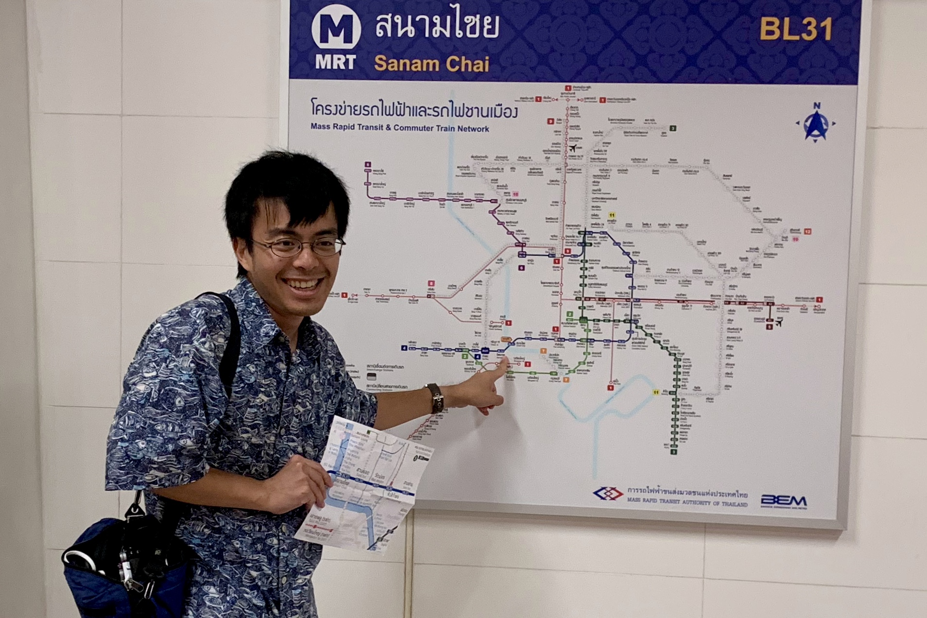
I have to thank a friend of a friend who at the time worked in the publicity department of Bangkok Expressway & Metro PCL, the operating company of the MRT Blue and Purple lines, who noticed the map and got it into the system.
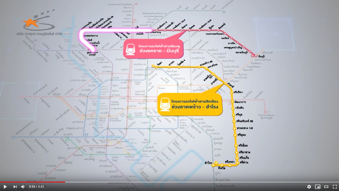
Mass Rapid Transit Authority of Thailand (MRTA)
Monorail on the Move | 27 Aug 2018 | by MRTA video on YouTube uses the framework of my map to create an animated version showing MRTA’s growing network and highlighting the two monorail projects in progress. That’s the Yellow Line and the Pink Line which runs near our neighborhood in Nonthaburi.
Gathering more examples… Spotted the map? Caught an error? Made your own? Let me know!